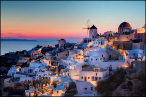
Santorini is probably the most famous Greek island. Its white-washed cube-like architecture, bright-blue domed Byzantine churches and glorious views over the expanse of the Aegean Sea are symbols of this little paradise.
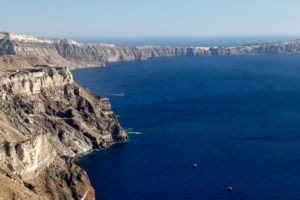
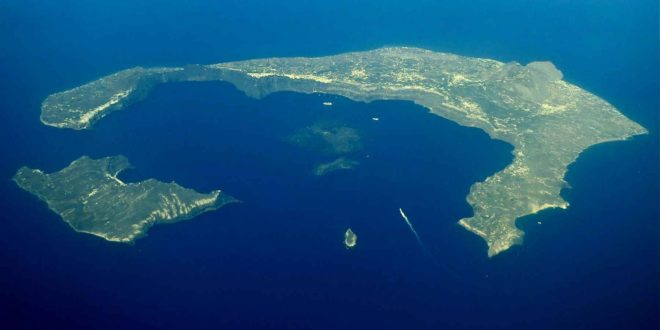
 Santorini is a volcanic island and it was centuries – or even millennia – in the making. Santorini’s half-moon shaped bay is the center of the Caldera. A caldera is a cauldron-like depression that occurs after the mouth of the volcano collapses from the eruption of the volcano.
Santorini is actually a group of islands located in the heart of the Aegean Sea. It’s comprised of five distinct islands: Santorini (the main island, also known as Thira), Thirasia, Aspronisi on the periphery and the two Kameni islands in center.
Santorini’s biggest volcano eruption was during the Minoan civilization 3500 years ago. Studies have shown that the island was the cradle of this advanced civilization which was ultimately destroyed by the explosion of the volcano. The eruption was so massive that it was possibly one of the biggest volcanic eruptions on earth. Santorini’s volcano also erupted in 97BC, 1570AD, 1707, 1866 and 1926, shaping the caldera and the islands, as we know them today.
The landscape consists of cliffs and rock along he caldera’s edge almost 1000’ above sea level. They also extend underneath the sea for an additional 1000’ – thereby creating the perfect harbor in the center.
 At the northernmost end of the caldera lies the quaint village of Oia (pronouced eee-uh) perched on the rim of the Caldera. Oia is famous for its panoramic views over the Caldera during sunset. The capital city of Fira is located on the eastern edge of the Caldera and also affords beautiful views of the Caldera from a different perspective.
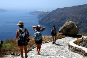
During our tour, Greece & the Greek Islands, September 26 – October 8, 2018, we will visit the towns of Oia and Fira. We’ll also hike a portion of the Caldera Trail to Oia. This is really the best way to experience the Caldera and the incredible views that are the hallmark of Santorini.

